Unmanned aircraft that keep an eye on your crops. A drone as the all-seeing eye of the farmer. Wageningen scientists are researching the possibilities using their very own toy: Okkie.Google the word drone and you will soon find out why Lammert Kooistra hates the word so much. The military uses of drones account for most of the more than 11 million hits. But no better word is available, really. ‘Unmanned platform is an alternative, but that is such a technical term.’ So the researchers on the Smart Inspector project have given their own drone, an octocopter, a nickname: Okkie.Okkie is the machine at the centre of the interregional project led by Kooistra (Geo-Information Science and Remote Sensing). The project’s aim is to deliver readymade applications for Okkies in agricultures and nature management. These are drones with special cameras on board that take pictures that beat anything the average satellite can produce. Made-to-measure information for farmers and nature managers. LostThe first sponsored link you see when you Google drone is to online retailer Wehkamp. You can buy one for 299 euros. It is a toy but it does have a small camera on board. Funnily enough, this is how Kooistra’s Geolab started too: with a drone from MediaMarkt, used to carry out some preliminary tests for a new line of research using drones. The first efforts actually went wrong straightaway, says Kooistra with a laugh. ‘One of our colleagues opened the window and suggested trying it out there and then. After thirty seconds we saw it crashing into a beech tree at 15 metres height.’ What did the Geolab team learn from this? To prepare properly before you start, says Kooistra.Safety and regulations regarding the use of drones are an important and relatively unexplored area. So some thorough preparations preceded the first real test flights two weeks ago at Kleve in Germany. ‘We used this summer mainly to train our pilots: one from Alterra and one from the university. First with a flight simulator on a computer and then on the grass outside Atlas.’ Because Okkie did not come from Wehkamp. It may look like a typical case of ‘toys for boys’, but this toy (an Altura Pro AT8, made by The Hague company AerialTronics) cost 10,000 euros. And once it is equipped with a special camera, it is worth twice that, says Kooistra. So a crash would be no joke. Nitrogen Smart Inspector is one of the projects under Interreg, a European funded programme aiming to stimulate cross-border collaboration in Europe. Wageningen UR is working on this project with the Hochschule Rhein-Waal in Kleve and various technology companies in both countries. Okkie is taking the Geolab into new territory. Kooistra: ‘For us this is an interesting halfway house between satellite images and sensors on the sprayer of a tractor.’The advantages of using drones are clear. Firstly, you can take pictures when you want to. Kooistra: ‘Satellite recordings are unreliable. With satellites you are always dependent on availability: whether one passes by just at the moment you want it to. Not to mention the weather. This is the Netherlands. In June and July the availability of satellite images depends on the amount of cloud. Whereas it is precisely in that period that farmers need immediate data on the growth of their crops. With a drone you are your own boss more.’There are other advantages too. You can attach any camera you want to Okkie. Including cameras that take pictures in parts of the spectrum that satellites do not measure. And with resolutions that satellites might manage, but only at a price. Launching your own Okkie is simply a lot cheaper.’We want to show that you can use this kind of platform to make exactly the right recordings at the right time for the farmer,’ explains Kooistra. ‘And that you can extract information from the recordings that the farmer needs. That you can see straightaway that more nitrogen is needed over here, or it is too dry over there.’These kinds of commercial applications already exist for satellite images. Kooistra: ‘One such service is Mijnakker.nl. But in terms of resolution, that doesn’t get beyond 20 metres. Farmers want between five and ten metres. Then you get a meaningful level of detail, and you can do something with it.’ Gone with the windBut Okkie has its limitations too. The weather, for instance. It is not clouds but wind that can pose problems for this light aircraft. A display by the octocopter planned for when the new building Orion reached its highest point had to be cancelled due to wind. Also, the weight of the camera suspended from this drone model is limited to a maximum of two kilos. ‘So this winter we are going to develop a system ourselves, together with colleagues in Kleve who know something about optical systems. We are not technologists.’ The Geolab’s expertise lies in the processing of the raw data into ready-to-use variables such as the amount of nitrogen in leaves. Kooistra: ‘From the raw data you have to create consistent pictures. Pictures that can be compared across times and places. Weather and atmosphere have an impact on the pictures the cameras take. You have to calculate out those effects and that is the knowledge we have to offer. That is why we are in the project.’Whether all farmers will have their own Okkies in future is anyone’s guess at this point. Kooistra: ‘Personally I think it is more likely that specialized companied will provide such services.’ What is more, Kooistra thinks they will use ordinary airplanes, not Okkies. ‘A multicopter like this is primarily for the experimental work. Ours can fly for six or seven minutes before its battery runs out. A little airplane with fixed wings can stay in the air for at least 20 minutes. The Land Degradation and Development chair group, which is a partner in the project, is due to purchase such a craft soon (see box). This will be the second Wageningen UR drone. Polystyrene Drones are an interesting new development for soil scientists and geomorphologists too. Along with the Geolab, the Soil Physics and Land Management chair group is also involved in Smart Inspectors. ‘The big advantage of drones is that you can make recordings whenever you want,’ explains Saskia Keesstra. ‘Just before or after a rain shower, for example. Where does the water stay lying on the ground and where does it drain away? That tells you something about the soil’s vulnerability to erosion.’The chair group will soon be purchasing its own drone from the MAVinci company. ‘An aircraft like that can be programmed in advance to fly a particular route. That way you can easily map out an entire river basin in detail, for example.’ According to Keesstra, drones are a supplement to traditional ways of gathering information about soil processes and sediment transport.Test flights with the Geolab’s drone produced some nice pictures of the campus.
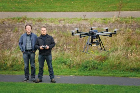
Taking flight with Okkie
Wageningen uses drone for remote sensing